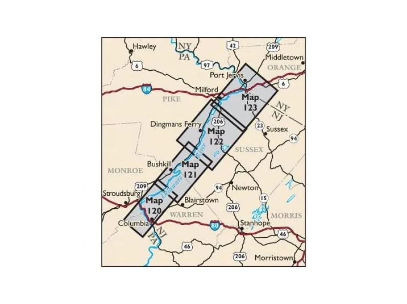
Explore the Kittatinny Ridge and Delaware River corridor with confidence using our updated Delaware Water Gap & Kittatinny Trails Map set—your essential waterproof hiking maps for Delaware Water Gap adventures. This vibrant four-map set (Maps #120-123), printed on durable, tear-resistant Tyvek®, covers over 325 miles of trails across New Jersey, Pennsylvania, and New York parklands, including 50+ miles of the Appalachian Trail.
The 2021 revised edition delivers unmatched accuracy with enhanced 20-foot elevation contours for safer navigation near cliffs and steep sections, plus updated stream crossings and newly added routes like Port Jervis Watershed Park’s multi-use trails and Hornbecks Creek paths. Discover expanded features: critical trail name/blaze updates across Worthington State Forest and High Point State Park, newly protected lands from conservation groups, and special Kittatinny Ridge trail guide additions like birding hotspots identified with Saw Mill River Audubon.
Hikers gain practical advantages: detailed junction-to-junction mileage, river access points, campsites, viewpoints, UTM coordinates, and enlarged insets for popular zones like High Point Monument. Whether planning a day hike along the Delaware River or tackling the 32-mile McDade Trail, these lightweight maps withstand rugged use while providing vital park boundaries, regulations, and emergency info. Perfect for thru-hikers, birdwatchers, or weekend explorers seeking reliable navigation through Delaware Water Gap National Recreation Area’s vast landscapes—experience precision where it matters most on the trail.