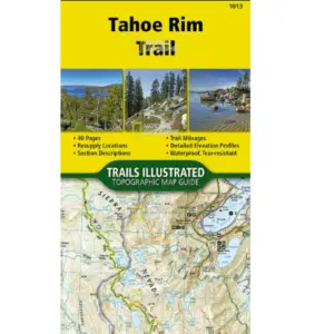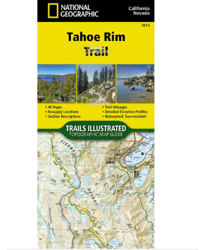
Explore the Tahoe Rim Trail with National Geographic’s Waterproof Topographic Map Guide
Navigating the breathtaking 175-mile Tahoe Rim Trail (TRT) just got easier with this tear-resistant, waterproof topographic map. Designed for hikers and adventurers, this guide covers the stunning Lake Tahoe Basin, including sections overlapping with the Pacific Crest Trail (PCT). Whether you’re trekking through alpine meadows or summiting Relay Peak (10,398 ft), this map ensures you stay on track.
Key Features:
Waterproof & tear-resistant – Printed on durable “Backcountry Tough” paper for all-weather use
Detailed trail profiles – Elevation changes and UTM grids for precise GPS navigation
Compact & lightweight – Easier to carry than traditional folded maps
Clockwise route layout – Starting at Tahoe City, each section (15–30 miles) is clearly mapped
Ideal for thru-hikers or weekend explorers, this guide breaks down the TRT into eight manageable sections, complete with elevation insights. No more struggling with flimsy maps—stay prepared and confident on your next Sierra Nevada adventure!
Plan your hike, conquer the terrain, and experience the beauty of Lake Tahoe like never before.